The New International Atlas
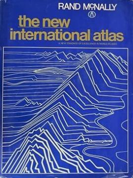
The monumental cartographic work The New International Atlas by Rand McNally from 1980 provides extremely precise multilingual maps and a detailed overview of the geopolitical landscape of the world during the Cold War.
The jubilee and expanded edition of The New International Atlas from 1980, published by the famous cartographic company Rand McNally, is considered one of the most respected and accurate world atlases of the 20th century. Created in collaboration with top international cartographic experts, this atlas stands out for its unique multilingual approach – all key terms, legends and indexes are printed in English, French, German, Spanish and Portuguese.
The atlas is recognizable by its large format, superb graphics and standardized map scale that allows for easier comparison of different regions of the world. Special attention is paid to detailed depictions of densely populated urban areas, relief maps and thematic depictions of natural resources, climate and population.
The 1980 edition is an exceptionally valuable historical and geopolitical document that faithfully depicts the world at the height of the Cold War. His maps clearly depict countries and borders that no longer exist, such as the Soviet Union, Czechoslovakia, Yugoslavia, and divided Germany. Due to its aesthetic value, professional meticulousness, and historical significance, this atlas is highly sought after by collectors and cartographic enthusiasts.
Angeboten wird ein Exemplar
- Die Abdeckung fehlt