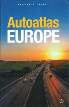
Autoatlas Europe

Autoatlas Europe

Vid Jakša Opačić

The Atlas offers detailed and updated maps of roads, highways, main thoroughfares, but also smaller regional roads in European countries.

This atlas was ideal for drivers and travelers who wanted to plan longer trips around Europe. It was especially useful in the era before the widespread availability of GPS technology, when printed atlases were the primary means of navigation.

Original title
Book of the road Europe
Translation
Vesna Bačić
Editor
Vid Jakša Opačić
Illustrations
Vera Vachova
Graphics design
Vera Vachova
Dimensions
28.5 x 19.5 cm
Pages
404
Publisher
Mozaik knjiga, Zagreb, 2008.
 
Latin alphabet. Hardcover.
Language: Croatian.
ISBN
978-9-53140-143-2

One copy is available

Condition:Used, excellent condition
 

Are you interested in another book? You can search the offer using our search engine or browse books by category.

You may also be interested in these titles

Istraživač oceana

Istraživač oceana

Sue Nicholson

Follow the adventure and travel the oceans in search of the blue whale, the largest living mammal.

Egmont, 2008.
Croatian. Latin alphabet. Hardcover.
6.98
Sve države svijeta : ukratko

Sve države svijeta : ukratko

Maps and basic information about every country in the world.

Mozaik knjiga, 2004.
Croatian. Latin alphabet. Paperback.
3.96
Zemljopisni pregled Azije, Afrike, Amerike i Australije za niže razrede srednjih škola

Zemljopisni pregled Azije, Afrike, Amerike i Australije za niže razrede srednjih škola

Ivo Juras

A geography textbook for all continents (except Europe) intended for lower grades of secondary schools in the Independent State of Croatia. The work of the prominent Croatian geographer and pedagogue Ivo Juras, illustrated with interesting black-and-white

Hrvatska državna tiskara, 1942.
Croatian. Latin alphabet. Paperback.
6.74
Geografija - s ilustrovanom geografskom čitankom, za treći razred građanskih škola

Geografija - s ilustrovanom geografskom čitankom, za treći razred građanskih škola

A rare interwar edition of a geography textbook (Belgrade, 1934) with 11 color atlas maps and 150 illustrations. Valuable as an antiquarian and cultural-historical document of education and cartography in the Kingdom of Yugoslavia.

IP Narodna prosveta, 1934.
Serbian. Cyrillic alphabet. Hardcover.
18.36
Atlas Azije

Atlas Azije

Denis Šehić, Demir Šehić, Ivan Bertić
Monde neuf, 2005.
Croatian. Latin alphabet. Hardcover.
3.56 - 3.74
Velika enciklopedija zemalja 3: Zapadna Europa

Velika enciklopedija zemalja 3: Zapadna Europa

The third volume of the "Great Encyclopedia of Countries" deals with the area of Western Europe (France, Monaco, Luxembourg...).

24 sata, 2009.
Croatian. Latin alphabet. Hardcover.
3.98