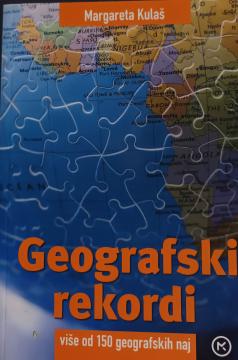
Geografski rekordi

Geografski rekordi

Margareta Kulaš
Illustrations
Shutterstock
Graphics design
Marija Morić
Dimensions
20 x 13.2 cm
Pages
87
Publisher
Mozaik knjiga, Zagreb, 2010.
 
Latin alphabet. Paperback.
Language: Croatian.
ISBN
978-9-53140-823-3

One copy is available

Condition:Used, excellent condition
 

Are you interested in another book? You can search the offer using our search engine or browse books by category.

You may also be interested in these titles

Slike iz obćega zemljopisa. Knjiga V., dio II.: Bugarska - Srbija - Crna Gora

Slike iz obćega zemljopisa. Knjiga V., dio II.: Bugarska - Srbija - Crna Gora

Ivan Hoić

"Pictures from General Geography" is a popular geographical work that depicts Bulgaria, Serbia and Montenegro through their natural features, population, history, economy and culture, with numerous illustrations and a geographical map.

Matica hrvatska, 1900.
Croatian. Latin alphabet. Hardcover.
24.72
Velika enciklopedija zemalja - Južna Amerika, zapadni i južni dio

Velika enciklopedija zemalja - Južna Amerika, zapadni i južni dio

24 sata, 2009.
Croatian. Latin alphabet. Hardcover.
5.98
Povijesni atlas

Povijesni atlas

Josip Lučić

The author worked on the creation of historical atlases and maps that showed the development of Croatian lands through the centuries.

Učila - Kartografija, 1982.
Croatian. Latin alphabet. Hardcover.
5.98
Velika enciklopedija zemalja – Zapadna Europa

Velika enciklopedija zemalja – Zapadna Europa

24 sata, 2009.
Croatian. Latin alphabet. Hardcover.
5.98
Zemljopisni pregled Azije, Afrike, Amerike i Australije za niže razrede srednjih škola

Zemljopisni pregled Azije, Afrike, Amerike i Australije za niže razrede srednjih škola

Ivo Juras

A geography textbook for all continents (except Europe) intended for lower grades of secondary schools in the Independent State of Croatia. The work of the prominent Croatian geographer and pedagogue Ivo Juras, illustrated with interesting black-and-white

Hrvatska državna tiskara, 1942.
Croatian. Latin alphabet. Paperback.
6.74
Atlas für Bürgerschulen und mehrklassige Volksschulen

Atlas für Bürgerschulen und mehrklassige Volksschulen

Anton E. Seibert

School atlas by Anton Emanuel Seibert for civic and multi-grade elementary schools, published in Vienna around 1901. Contains 19 main and 12 auxiliary maps of Europe and the world, as well as depictions of Austria-Hungary.

Eduard Hölzel Verlag, 1901.
Croatian. Latin alphabet. Hardcover.
54.36