National Geographic Atlas of the World
Retka knjiga

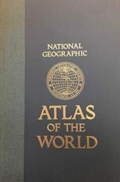
National Geographic Atlas of the World

The fifth edition of the National Geographic Atlas of the World from 1981 is a monumental cartographic work. It contains detailed maps, satellite imagery, and geographic data from the height of the Cold War.

The fifth edition of the famous cartographic atlas National Geographic Atlas of the World, published in 1981, represents one of the most comprehensive and high-quality editions of the National Geographic Society from the second half of the 20th century. Recognizable by its large format and distinctive yellow accents, this atlas combines superb cartographic precision, rich thematic units and high aesthetic value for which this publisher is world-renowned.

The content includes extremely detailed physical and political maps of all continents, oceans, polar regions, as well as space and the Solar System. The 1981 edition offers a fascinating historical insight into the geopolitical picture of the world at the height of the Cold War – with clearly delineated borders of the USSR, Yugoslavia, Czechoslovakia and political divisions in Asia and Africa before the collapse of the bloc system.

In addition to classic maps, the atlas contains a rich text section, statistical data on the population and economy, climate diagrams and the most modern satellite images of the Earth at the time. This edition is highly regarded among antiquarian book collectors, geographers, and cartography enthusiasts, and serves as an excellent visual and historical document of a time.

Dimenzije
48 x 32 cm
Broj strana
385
Izdavač
National Geographic Society, Washington, 1981.
 
Latinica. Tvrde korice.
Jezik: Engleski.

Jedan primerak je u ponudi

Stanje:Korišćeno, u odličnom stanju
Dodato u korpu!
 

Zanima Vas i neka druga knjiga? Možete pretražiti našu ponudu pomoću pretrage ili prelistati knjige po kategorijama.

Možda će Vas zanimati i ovi naslovi

Grosser Autoatlas Europa: 1:800000

Grosser Autoatlas Europa: 1:800000

Freytag & Berndt, 2011.
Hrvatski. Latinica. Tvrde korice.
9,74 €
Zemljopisni pregled Azije, Afrike, Amerike i Australije za niže razrede srednjih škola

Zemljopisni pregled Azije, Afrike, Amerike i Australije za niže razrede srednjih škola

Ivo Juras

Ein Geographie-Lehrbuch für alle Kontinente (außer Europa) für die unteren Klassen der Sekundarstufe im Unabhängigen Staat Kroatien. Das Werk des bedeutenden kroatischen Geographen und Pädagogen Ivo Juras, illustriert mit interessanten Schwarz-Weiß-Abbild

Hrvatska državna tiskara, 1942.
Hrvatski. Latinica. Broširano.
6,74 €
Autoatlas Europe

Autoatlas Europe

Vid Jakša Opačić

Der Atlas bietet detaillierte und aktualisierte Karten von Straßen, Autobahnen, Hauptverkehrsstraßen, aber auch kleineren Regionalstraßen in europäischen Ländern.

Mozaik knjiga, 2008.
Hrvatski. Latinica. Tvrde korice.
7,986,38 €
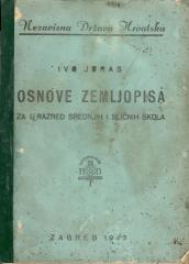
Osnove zemljopisa za I. razred srednjih i sličnih škola

Osnove zemljopisa za I. razred srednjih i sličnih škola

Ivo Juras

Udžbenik opće geografije namijenjen prvom razredu srednjih škola u NDH. Sadrži osnove fizičke i opće geografije, karte i ilustracije. Djelo istaknutog hrvatskog geografa i pedagoga Ive Jurasa.

Hrvatska državna tiskara, 1943.
Hrvatski. Latinica. Broširano.
7,34 €
Enciklopedijski atlas svijeta

Enciklopedijski atlas svijeta

Graham Bateman, Victoria Egan

Enciklopedijski priručnik za školu i svaki dom. Više od 500 stranica, 200 mapa i više od 500 fotografija i ilustracija. Bogat i raznovrstan geografski, istorijski i ekonomski sadržaj u enciklopedijskom formatu.

Extrade, 2001.
Hrvatski. Latinica. Broširano.
32,46 €